Arrowpointe Maps v1.0.5
Version 1.0.5 of Arrowpointe Maps was just released. You can read about all the improvements on the Change History page. The changes that most impact user experience and the application’s capabilities are:
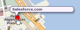
- Added a mouseover reaction on the map to show the Info Window title when a marker is moused over. This allows a user to see which record is which without opening up each marker.

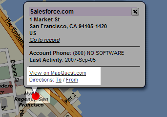
- Added links to all map marker Info Windows to allow the address to be mapped or used in driving directions on mapquest.com.

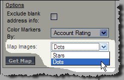
- Added support for Dots as a map image (see image above). Allows the user to choose between Dots or Stars and it remembers the last selected value for the next map run.

- Added “does not contain†as a comparison operator to be used on String map filter fields.
- Added a “Last 7 Days†and Next 7 Days†option to be used on Date map filter fields.
NOTE: If you are using Arrowpointe Maps and are confused by these posts about new versions, just know that these updates are happening automatically for you. You do not need to re-download the AppExchange application. Changes to the AppExchange package will be few and far between and those will be communicated very explicitly.
About Arrowpointe Maps
Arrowpointe Maps is an on-demand mapping platform that facilitates a conversation between Salesforce.com & MapQuest allowing for easy deployment of mapping capabilities in your organization and providing end-users a simple means for mapping their data. Arrowpointe Maps is configurable and can be tailored to your organization, so that your users can work with their information in a meaningful way.
The official location for information on Arrowpointe Maps is its product page at http://www.arrowpointe.com/maps. There, you will find answers to the most frequently asked questions, screencasts and links to its AppExchange page.