Archive for Arrowpointe Products Category Feed

Geopointe 1.6

Geopointe 1.6 has been released on AppExchange.  The Update History page has the full list of changes in this release.  Below are highlights of the major changes, especially those that will impact end users’ experience with the application.  You should make your users aware of these changes.

Ad-Hoc Filtering

You can now apply filters to your queries from the Map page. You are no longer required to create and save a data set to get a filtered look at your data. You can still create and use Data Sets like before and this filter feature on the map page is a way to apply additional filters to the query. This feature should significantly reduce the number of data sets you require to have pre-created.

Coloring Markers

A new option called “Color Markers By” is available when mapping. This drop-down will list the fields you have available on the object. Selecting a field prior to clicking the map button tells Geopointe to ensure unique values from that field are put into a unique color. There are 20 pre-defined colors right now and they are the same colors used in Salesforce Dashboards.

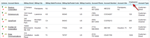
Child Object Filters

You have always been able to filter on parent records (e.g. show Opportunities linked to Accounts with an Account Type = Customer).  Now you can use Child Relationships to filter parent objects.  For example, the image below is for an Account data set and is filters for Accounts with:

  • Account Type starting with “Customer”
  • Opportunities that have been Won and are of an Amount > 10,000

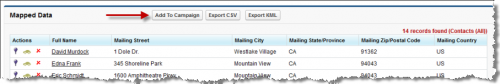
Enhanced Data Tables

The table below the map was significantly enhanced to allow pagination, searching, improved sorting and better rendering of values based upon data type.

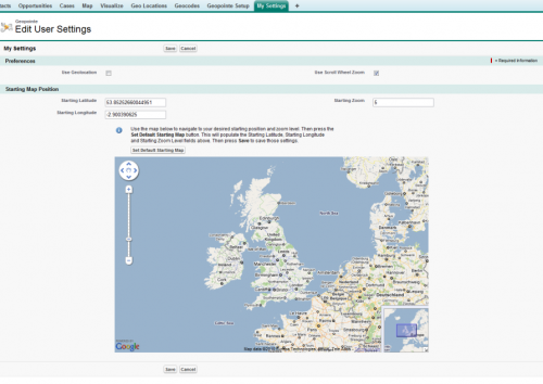
Numbered Map Markers

This feature can be enabled via a User Preference on the My Settings page. It will add a number of each pin on the map and the same icon will display in the table so you can easily see the relationship between the table and the map.

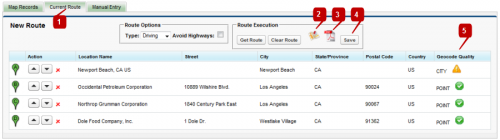
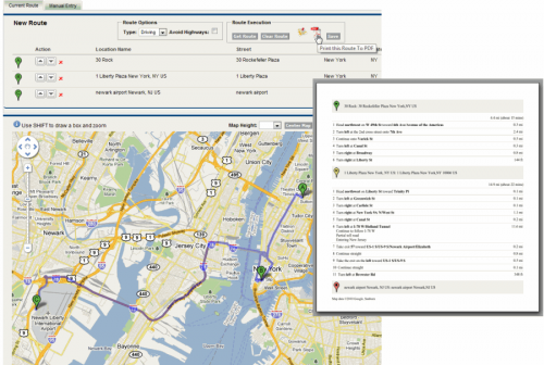
Draggable MapQuest Routes

MapQuest routes are now draggable.  Once you generate a route, drag the route line around the page to tell it you want to go a different way.

View State Issue Is Gone!

Previous versions could throw an error regarding “View State” if too many records were added to the map.  This issue has been eliminated.  As a result of this, performance on the page should also be greatly improved.

Additional Items

  • Added a user preference to hide the Salesforce Sidebar from the Map & Visualize page. By default, the sidebar is displayed.
  • Many performance and optimizations enhancements

Comments off comments feed

Add To Campaign

The Geopointe 1.4 release includes a feature called Add To Campaign. This feature will sense whether leads or contacts are on the map and, if the running user has the authority to manage campaign members, an Add To Campaign button will appear, allowing them to add those leads and contacts to an existing Salesforce campaign.

Watch the video below for a demonstration of this functionality.

(YouTube not working? Download the video directly from our site)

Comments off comments feed

Geopointe 1.4

This was also posted to the new Arrowpointe Product blog, which is the main blog for product information. Please subscribe (rss, email)

Geopointe 1.4 has been released on AppExchange.  The Update History page has the full list of changes in this release.  Below are highlights of the major changes, especially those that will impact end users’ experience with the application.  You should make your users aware of these changes.

Current users can find the upgrade instructions here.

Routing

1. The Records to Route list has moved.  It is now located in a tab that will dynamically appear above the map called “Current Route”.

2. A link to send the route to the Google or MapQuest website (based upon your subscription) will allow you to send those points out to the mapping provider’s site to work on things there.

3. After clicking Get Route, the route is available for printing to PDF.

4. Save Routes! When this button is clicked, the system will prompt them for a name.  If the user opens a saved routes, additional buttons will appear here (Save As and Delete).

5. Geocode quality is now displayed to help the user know whether they have mapped a location to a specific address or just to the middle of a city/state/zip.

Print Routes to PDF

After generating a route, you can click the PDF icon to pull that route into a PDF for printing or emailing.

Run Saved Routes

The list of Saved Routes is available on the Manual Entry tab. Click the Run Route button to launch the route.

Sharing Routes

Once a route has been saved, it can be shared with other Geopointe users in the organization.  Just copy the link from the browser after running a route.  It will look something like https://geopointe.na1.visual.force.com/apex/map?routeId=a0830000008G6MqAAK.  Running someone else’s route is just like running your own with a few minor changes to the UI.

1. Text will indicate that you are running a saved route of another user.

2. You have no access to the Save and Delete buttons.

Add To Campaign

When a lead or contact map is run, the system will assess whether the current user has the rights to add Campaign Members.  If so, an Add To Campaign button will appear at the top of the list of mapped records. When clicked, the user is launched out to the Add to Campaign screen in a separate browser window/tab.

Sortable Lists

When records are returned with the map, you can sort the list by any column. The system is smart as to whether it’s a text or number field, so it sorts it properly.

My Settings

A new tab was added to allow users to edit their personal settings. This tab goes to the same destination as the My Settings link just above the main Map on the Map tab.

  • Users can now specify their default starting map
  • Users can now enable/disable scroll wheel zooming

More

There is more. The Update History page has the full list of changes in this release.

Comments (2) comments feed

Map as Lookup Field

This was also posted to the new Arrowpointe Product blog. We are moving all product specific information to that new blog and keeping this blog focused on developer related information. Please subscribe (rss, email)

Geopointe has a number of under-the-cover features (and more to come) that allow you to integrate with the application.  One such feature is the ability to use the map as a means of populating a Lookup field.

Below is a video showing this feature in action.

(for best results, choose an HD viewing option after starting the video and use full-screen mode)

Enabling the Feature

The feature is enabled through the use of a Custom Button that simply passes additional parameters across in the URL.  The URL in the video example is:

/apex/geopointe__Map?
Id={!Account.Id}
&wbRecordId={!Account.Id}
&wbField=Related_Account__c
&wbLookupObject=Account
&wbButtonText={!URLENCODE("Relate This Account to " & Account.Name)}

Let’s break it down

/apex/geopointe__Map?
Id={!Account.Id}

The above is the URL from the button included with the application. It is required to sent the user to the proper page in the proper context.

&wbRecordId={!Account.Id}

wbRecordId is the ID of the record we will be writing back to.

&wbField=Related_Account__c

wbField is the field on that record we will be populating.

&wbLookupObject=Account

wbLookupObject is the object type that we will be searching for and populating the lookup field for.

&wbButtonText={!URLENCODE("Relate This Account to " & Account.Name)}

wbButtonText is optional, but can be included if you want to customize the button’s text. It is recommended to use the URLENCODE function when specifying your text, especially if you are merging in data from the system.

Comments off comments feed

Introducing Geopointe

This was also posted to the new Arrowpointe Product blog. We are moving all product specific information to that new blog and keeping this blog focused on developer related information. Please subscribe (rss, email)

We are pleased to announce the release of our newest application, Geopointe. Geopointe integrates Force.com with Google Maps and MapQuest and is the premier Force.com geo/mapping solution providing numerous ways for end-users, administrators and developers to take advantage of geo data and maps.

Highlights of Geopointe include (but is not limited to):

  • Map any Salesforce object
  • Perform proximity searching (show me what’s nearby me)
  • Create custom data sets (queries), both personal and public ones
  • Export your results to CSV (Excel) or KML (Google Earth)
  • Obtain multi-point driving directions
  • The Visualizer helps create dashboard-like summaries of your data
  • Automated, Scheduled Geocoding processes your data at 1000+ records per minute
  • Get cleansed address data
  • Contains an “API” with global Apex methods, Visualforce Components and the ability to extend the application using custom buttons.
  • All existing Arrowpointe Maps customers get a free license transfer to Geopointe for the same user count and expiration date as their current license with a goal to get users off of Arrowpointe Maps and onto Geopointe.

To learn more, you can:

(for best results, choose an HD viewing option after starting the video and use full-screen mode)

Comments off comments feed

Next entries » · « Previous entries